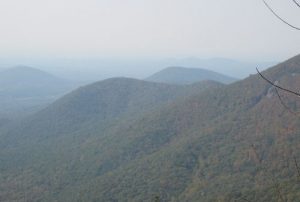
Unicoi Gap to Woody Gap - Member Hike
| Hike Name: | Unicoi Gap to Woody Gap |
|---|---|
| Country: | United States |
| State: | Georgia |
| Nearby Town: | Suches |
| Rating: |  |
| Directions: | N34 48.055 W83 44.577 Route 17 to the trailhead, south out of Hiawasse |
| Total Hike Distance: | 31.00 miles |
| Hike Difficulty: | Very Difficult |
| Permit Required: | No |
| Hike Type: | One-Way, Shuttle Hike |
| Hike Starts: | Unicoi Gap, Rt 17 |
| Hike Ends: | Woody Gap, Rt 60, Suches, Ga |
| Trails Used: | AT |
| Backcountry Campsites: | Yes |
| Backcountry Water Sources: | Streams, Springs |
| Management: | National Park Service |
| Contact Information: | Chattahoochee National Forest Blue Ridge Ranger District Blairsville, Ga 706-745-6928 |
| Best Season: | Winter, Spring, Fall |
| Users: | Hikers |
| Road Conditions: | Secondary Paved Roads |
| Hike Summary: | We started out from Unicoi Gap on a sobo hike ultimately ending at Woody Gap. There is a large parking area off of the road and the sobo trail is across the road. the trail immediately starts to ascend Blue Mountain with an approximate 1100 foot climb to the top of Blue Mt. The trail was found to be in good shape with some switch backs. At the top we found the shelter and privy. A good place to catch your breath after the 2.2 mile climb. On this date 10/11/10 we found no water at the shelter. The trail continued on nicely, not much in the way of rocks, some, but certainly not like the north east. The trail followed an old road bed for several miles and thats where we came across or first water. We filtered it from a pool below the road bed. This road bed was a great walk, it followed the contour of the mountain and was apparently an old CC project. There was evidence of other potential water spots but not on this day. We arrived at Low Gap shelter about 330 PM and 9.9 miles into the hike. To early to quit so we pushed on, the first site we came to was on the other side of Poor Mt. it was a hard climb. It was 4 miles from Low Gap and there were no camp sites. We left there in the AM and the first water we came to was at Hog Pen Gap. This was another spot at the road that had a large parking area. The water was on the sobo side of the road off of the trail. The flow was adequate at best. We pushed onto Neels Gap. when we reached Levelland Mt the skies opened up, thunder lightening rain and hail came upon us. The trails became flooded. There was no water supply between Hog Pen and Neels. After getting to Neels we dried our stuff and bedded for the night. Mountain Crossings is a nice store at the gap where hiker wisdom is the norm. In the morning we pushed up to Blood Mt, a great leg of switch backs and a 1300 climb. It didn't feel that bad. At the top there are some rock crops, with incredible views. The shelter was found to be in good shape as was the privy. I didn't check the water situation there. Prior hikers said there was none. Its an historic shelter. The last leg of the trail had several camp sites and some water in the area of Slaughter Gap. Woody Gap is another spot on the road where you can park. There are some facilities there as well. |


There are no comments yet.